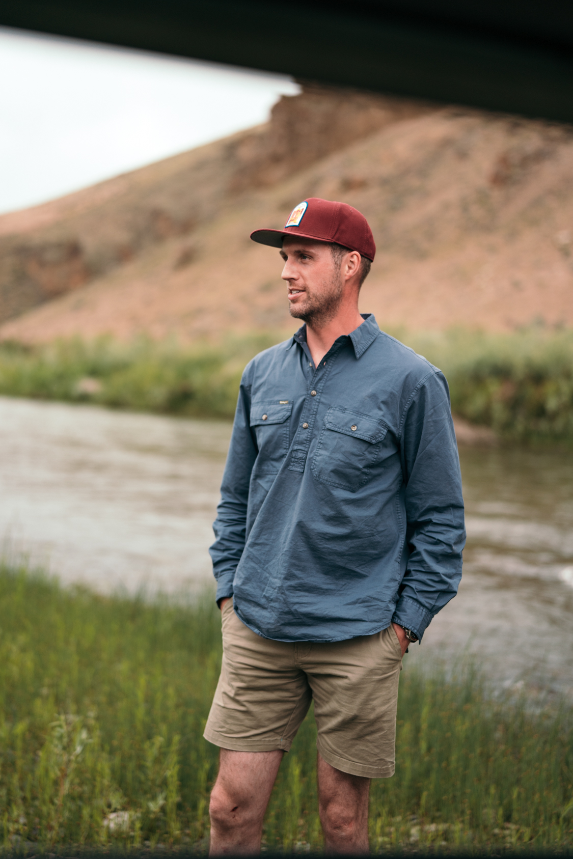
June 12, 2026
Monument Review
Source: NRDC

A congressional effort to overturn the Bureau of Land Management's 2024 management plan for Grand Staircase-Escalante National Monument has failed after the Senate's 60-day fast-track voting window expired without action. The resolution, which would have used the Congressional Review Act to nullify the plan, now faces a Senate filibuster that its supporters lack the votes to overcome.
The failed repeal targeted BLM's updated management framework for the 1.87 million-acre monument in southern Utah, which was restored to its original boundaries in 2021 after being reduced by nearly half during the previous administration. The management plan governs grazing, recreation, and development activities across the monument's scientifically significant landscape.
What Congress tried to overturn here isn't just another federal plan—it's protection for one of the most geologically complete sequences on Earth. Grand Staircase-Escalante preserves 200 million years of sedimentary history in perfect chronological order, from the white Navajo Sandstone cliffs down through the red Wingate and Chinle formations that hold some of the richest Late Triassic fossil beds in North America. The Kaiparowits Plateau alone has yielded more than a dozen new dinosaur species since the monument's designation, including Wahweap Formation discoveries that fill crucial gaps in our understanding of the final 15 million years before the mass extinction.
The management plan that nearly got axed also protects thousands of ancestral Puebloan sites across the Escalante canyons and ensures continued access to what many consider the finest slot canyon country in the Colorado Plateau. Without federal oversight, this landscape—which took 200 million years to create and contains irreplaceable paleontological and archaeological resources—would face the kind of piecemeal development pressure that has already compromised less-protected areas of the Colorado Plateau. Some things, once lost to drilling rigs or ATV damage, don't regenerate on human timescales.
April 3, 2026
Mining
Source: High Country News

The Bureau of Land Management opened a seven-day public comment period on a proposal to reverse the Biden administration's 20-year ban on oil and gas drilling within 10 miles of Chaco Culture National Historical Park. The comment period, which ends April 7, falls during Easter, Passover, and traditional Pueblo holidays, drawing criticism from New Mexico's congressional delegation and tribal officials.
Chaco Canyon holds deep spiritual significance for numerous tribes and pueblos, with the site containing thousand-year-old structures and serving as a living cultural landscape. New Mexico's Land Commissioner had separately issued a 20-year ban on drilling state trust lands near Chaco in 2023, covering more than 72,000 acres.
Tribal officials criticized the online-only comment system as creating barriers for community members and elders with limited internet access. Acoma Pueblo Governor Charles Riley called for expanded comment options including mail or in-person submissions, while the All Pueblo Council of Governors pledged to continue fighting the proposed changes.
Chaco Canyon represents the pinnacle of Ancestral Puebloan civilization — a planned urban center that flourished between 850 and 1150 CE, featuring massive stone structures aligned with celestial events and connected by hundreds of miles of engineered roads. The great houses like Pueblo Bonito contain rooms that haven't been disturbed for nearly a millennium, while the surrounding landscape holds countless smaller sites, ancient roads, and shrine complexes that form an integrated sacred geography still actively used by modern Pueblo communities. This isn't archaeological theory — it's a living cultural system that has persisted for a thousand years.
A seven-day comment period during major religious holidays reveals either stunning ignorance or deliberate exclusion of the very communities most affected. The online-only format particularly targets tribal elders — the traditional knowledge holders whose voices should carry the most weight in decisions about their ancestors' homeland. Previous extensive consultation processes for Chaco protection took years and involved dozens of tribal meetings, because that's what genuine consultation requires.
What's at stake isn't just proximity to a national park — it's the integrity of an entire cultural landscape where every mesa, canyon, and shrine location connects to a thousand-year continuum of ceremony and meaning. Once fracking infrastructure fragments this geography, that connection becomes permanently severed, no matter what future administrations might want to protect.
April 2, 2026
Mining
Source: NRDC

The Natural Resources Defense Council filed a federal lawsuit challenging the current administration's approval of Gulf of Mexico oil and gas leases without conducting required Endangered Species Act consultations. The suit argues that federal agencies violated environmental law by fast-tracking lease approvals in critical habitat areas for threatened marine species.
The challenged leases cover Bureau of Land Management-administered federal waters that serve as feeding and migration corridors for endangered species including North Atlantic right whales, sea turtles, and Gulf sturgeon. Environmental groups claim the bypassed reviews would have identified potential conflicts and required protective measures.
The Gulf of Mexico's outer continental shelf represents one of North America's most biodiverse marine ecosystems, where ancient river deltas created a complex web of deepwater canyons, salt domes, and chemosynthetic communities that have supported marine life for millions of years. These same geological formations — particularly the Jurassic-era salt deposits and Miocene-era sedimentary layers — contain the petroleum reserves now being leased without the species impact analysis that has been standard protocol since the 1970s.
What's at stake isn't just procedural compliance but the intersection of industrial activity with critical life cycles that cannot be relocated or rescheduled. North Atlantic right whales, reduced to fewer than 340 individuals, depend on Gulf waters for calving during winter months — a behavior pattern established over millennia that brought them through previous climate shifts and population bottlenecks. The seismic surveys and drilling operations these leases enable will occur in the exact deepwater areas where pregnant females seek the warm, calm conditions essential for successfully raising calves that represent the species' entire reproductive future.
April 1, 2026
BLM / USFS Policy
Source: High Country News

The U.S. Forest Service announced plans to move its headquarters from Washington, D.C., to Salt Lake City and eliminate all nine regional offices in favor of 15 state-based offices. The agency will also close research and development facilities in more than 30 states while maintaining fire management programs. The restructuring aims to make the agency more "nimble, efficient and effective" with a focus on boosting timber production.
The plan follows an earlier proposal that drew overwhelming opposition during public comment periods, with more than 80% of 14,000 comments expressing concern. Critics including former Forest Service officials, conservation groups, and tribal representatives argue the reorganization will weaken rather than strengthen the agency by uprooting thousands of employees and compromising ecological management capabilities.
The Forest Service has managed 193 million acres through nine regional offices since the 1930s — a structure that evolved to match the ecological and administrative reality of managing landscapes that don't respect state boundaries. The Intermountain Region, for instance, coordinates fire management across the continuous sagebrush ecosystem spanning multiple states, while the Pacific Northwest Region manages old-growth forests from the temperate rainforests of southeast Alaska to the Cascade volcanic arc. Breaking this system into state-based offices ignores a century of learning about how forest ecosystems actually function.
Moving headquarters to Salt Lake City places the agency's leadership in a state where 65% of the land is federally managed — closer to the ground, but also closer to the extraction industries and state politicians who've spent decades trying to wrest control of federal lands. The closure of research stations, particularly the Portland facility's critical work on climate adaptation and species management, comes precisely when Western forests face unprecedented fire, drought, and pest pressures that demand science-based solutions.
What's at stake isn't just bureaucratic efficiency — it's whether the Forest Service retains the institutional knowledge and regional coordination capacity to manage landscapes facing climate change. The agency that guided forest recovery after the clearcut era of the early 1900s is being reorganized by people who seem to believe that era's approach was the right one all along.
March 24, 2026
BLM / USFS Policy
Source: Inside Climate News

The Trump administration's plan to rescind the 2001 Roadless Rule limiting road construction on millions of acres of national forests relies heavily on the argument that roads are necessary for wildfire prevention and response. However, a new study published in Fire Ecology found that wildfires were four times more likely to ignite within 50 meters of roads than in roadless forest areas, examining ignition data across all Forest Service regions from 1992 to 2024.
The findings challenge the USDA's justification for opening previously protected roadless areas to timber harvests and road construction. Former Hotshot firefighter Lucas Mayfield said lack of roads wouldn't make his top five list of obstacles to effective wildfire response. The study reveals a management paradox: while roads enable access for firefighting, they dramatically increase human-caused ignitions, which account for 89 percent of wildfires nationwide according to Congressional Research Service data.
The Forest Service's own 2001 environmental impact statement acknowledged what fire scientists have long known: "Building roads into inventoried roadless areas would likely increase the chance of human-caused fires due to the increased presence of people." This wasn't speculation—it was based on decades of ignition data showing that people, not lightning, start nearly nine out of ten wildfires. The 58.5 million acres covered by the Roadless Rule represent some of the most intact forest ecosystems remaining in the Lower 48, including old-growth stands that survived centuries without roads and the fire suppression era that followed.
The new study's fourfold increase in ignition probability near roads isn't just a statistical curiosity—it's a fundamental challenge to the agency's current reasoning. These roadless areas often contain the headwaters of major river systems and provide crucial wildlife corridors between designated wilderness areas. Once you punch roads into these landscapes for timber access, you've permanently altered their character and fire regime.
What's at stake isn't just tree cover that will eventually grow back, but the integrity of entire watersheds and the quiet spaces that exist beyond the sound of chainsaws and logging trucks. The draft environmental impact statement will determine whether these last roadless strongholds remain intact or join the 380,000 miles of existing roads already fragmenting the national forest system.
March 19, 2026
Mining
Source: Inside Climate News

Oil companies secured drilling rights to more than 1.3 million acres across Alaska's Arctic on Wednesday, generating a record $164 million in the first lease sale in the region since 2019. The leases cover portions of the 23-million-acre National Petroleum Reserve, the largest single unit of public land in the country, including areas within a million-acre conservation easement that federal courts ordered protected just days before the sale.
The Bureau of Land Management had granted the conservation right of way to local Alaska Native leaders in 2024, prohibiting leasing within its boundaries to protect caribou calving grounds and subsistence hunting areas. Though the administration canceled the easement in December, a federal judge reinstated it with a preliminary injunction on Monday, creating legal uncertainty over the validity of leases sold within the protected corridor.
The National Petroleum Reserve represents one of the continent's last intact Arctic ecosystems, supporting the 200,000-animal Western Arctic Caribou Herd whose migration routes have remained unchanged since the Pleistocene. The reserve's coastal plain provides critical calving grounds for this herd, which feeds the subsistence economy of Iñupiat communities like Nuiqsut, where families have harvested caribou along these same routes for over a thousand years. The million-acre conservation corridor specifically protects the bottleneck areas where pregnant caribou cows must pass to reach calving grounds—a biological imperative that can't be rerouted around industrial infrastructure.
The legal chaos surrounding this sale—leases sold on lands a federal court ordered protected just 48 hours earlier—creates a mess that will take years to untangle in court while companies begin seismic surveys and road construction. What's at stake isn't just another oil field but the integrity of migration corridors that took millennia to establish and, once fragmented by roads and drilling pads, cannot be restored within any human timeframe.
March 19, 2026
BLM / USFS Policy
Source: High Country News

The Bureau of Land Management announced plans to revise management of 2.5 million acres in western Oregon, ramping up timber harvest to "historically higher levels" and reevaluating protected areas of critical environmental concern. The agency cited wildfire management and Trump administration executive orders boosting domestic timber production as justification for the changes.
The Oregon and California Railroad Lands have been managed for timber since 1937, with harvesting peaking at over 1 billion board feet annually in the 1960s before dropping sharply in the 1990s under the Northwest Forest Plan to protect endangered species. The current management plans, approved in 2016, provide less protection than the previous framework and have already faced litigation from conservation groups over timber sales and old-growth logging.
These Oregon and California Railroad Lands exist because of a 19th-century railroad subsidy gone wrong — Congress granted alternating sections to build tracks that were never completed, creating the checkerboard pattern that still defines western Oregon's public lands today. What makes places like Valley of the Giants irreplaceable isn't just their age, but their rarity: less than 5% of Oregon's original old-growth Douglas fir forests remain, and these 400-year-old giants represent ecosystems that developed over millennia of low-intensity fires and complex nutrient cycling that industrial forestry can't replicate.
The BLM is essentially proposing to return to 1960s-era extraction levels on landscapes that have already been heavily logged for eight decades. While forest thinning can reduce wildfire risk when combined with prescribed burns, the agency's broad language about "historically higher levels of production" suggests something beyond targeted fuel reduction. What's at stake isn't just trees, but the habitat complexity that supports 40-plus species of mammals and over 200 bird species in these forests — biodiversity that disappears when old-growth becomes "Doug-fir farms." Once these remaining old-growth stands are cut, the specific conditions that created them — centuries of uninterrupted forest succession — can't be restored within any human timeframe.
March 19, 2026
Mining
Source: Inside Climate News

The Trump administration completed its first Arctic lease sale since 2019 on Wednesday, auctioning drilling rights across 1.3 million acres of Alaska's National Petroleum Reserve for a record $164 million. The sale included areas within a million-acre conservation corridor that had been granted to Alaska Native leaders in 2024 to protect caribou calving grounds and subsistence hunting areas. Though the administration canceled this protection in December, a federal judge issued a preliminary injunction Monday reinstating the conservation agreement pending ongoing litigation.
The 23-million-acre reserve represents the largest single unit of public land in the country, supporting polar bears, caribou, migratory birds, and other Arctic species across vast undeveloped wilderness. Leaders from Nuiqsut, the Alaska Native community closest to the drilling areas, have opposed expanded oil activity, citing threats to the caribou herd they depend on for subsistence. The conservation corridor was originally established to offset impacts from the controversial Willow oil project approved in 2023.
The National Petroleum Reserve sprawls across tundra that emerged from beneath Pleistocene ice sheets roughly 12,000 years ago, creating the delicate permafrost ecosystem now supporting the Teshekpuk Lake caribou herd's ancient migration routes. This isn't just any wilderness—it's the Arctic Coastal Plain, where millennia of freeze-thaw cycles built the polygonal tundra patterns that define one of Earth's most specialized ecosystems. The Iñupiat have tracked these caribou across this landscape for over a thousand years, their subsistence calendar tied to migration patterns older than European contact with North America.
What makes Wednesday's auction particularly consequential is the legal limbo surrounding that million-acre conservation corridor. Created specifically to protect calving grounds from the Willow project's industrial footprint, it represents a rare acknowledgment that some landscapes function as integrated systems where drilling fragments the whole. The preliminary injunction means oil companies now hold leases they may not be able to develop, setting up years of litigation while the narrow window for Arctic construction seasons ticks by.
Beyond the immediate legal uncertainty, this sale forecloses a conservation approach that recognized ecological limits in the warming Arctic. Once heavy equipment begins crossing this permafrost during the brief construction windows, the thaw patterns alter permanently. The Teshekpuk caribou herd's calving success, already stressed by climate change, faces additional disruption just as the Arctic warms faster than anywhere else on Earth—a convergence of industrial and climatic pressures that makes this tundra impossible to restore once compromised.
March 15, 2026
BLM / USFS Policy
The CRA Was Used a Record 22 Times Last Year. Public Lands Are Now in the Crosshairs.
Source: Republic.land / Harvard Environmental & Energy Law Program
Analyses from multiple legal and policy research organizations confirm that Congress used the Congressional Review Act 22 times in 2025 — more than in all previous years combined. The law had been used once before 2017, 16 times during the first Trump administration, and three times in 2021. Of the 22 resolutions passed in 2025, 18 targeted environmental protections, making it the most concentrated use of the statute against environmental and public lands rules in history.
The Boundary Waters mineral withdrawal and the Grand Staircase-Escalante management plan represent the frontier of this expansion: for the first time, the CRA is being applied to a public land order and a national monument management plan respectively. Legal scholars flag the statute's "substantially the same" clause as the mechanism that distinguishes this moment from earlier rollbacks. Unlike boundary reductions via presidential proclamation, which can be reversed by a successor, CRA resolutions that become law permanently restrict agencies from issuing materially comparable regulations — meaning many of the 2025 rollbacks may prove difficult or impossible to restore even under a future administration with different priorities.
The framework that governs American public lands was built incrementally over about 70 years, from roughly 1891 to 1976. The Forest Reserve Act, the Antiquities Act, the National Park Service Organic Act, the Wilderness Act, the Federal Land Policy and Management Act: each piece was a response to something — usually resource extraction running ahead of any legal constraint, or the loss of landscapes that were gone before anyone thought to protect them. Mesa Verde was being looted. The forests of the Pacific Northwest were being cleared with no regeneration requirements. The response, at each point, was to build a new legal layer. The Congressional Review Act was passed in 1996 — the same year Grand Staircase-Escalante was established — as an oversight mechanism for federal rulemaking. For most of its first two decades, it was rarely used. It's now being deployed as the fastest tool available to dismantle that 70-year framework, one layer at a time.
The "substantially the same" clause is where the long-term stakes are highest, and it's the part of this story that's getting the least attention. When Congress disapproves a rule under the CRA, it doesn't just remove that rule — it places a legal cloud over anything that resembles it in the future. Courts haven't defined the standard clearly in the public lands context, and that ambiguity is itself a deterrent. A future BLM director who wants to protect the Grand Staircase fossil beds with a new management plan, or a future Interior Secretary who wants to reinstate a mining moratorium in the Boundary Waters watershed, faces immediate litigation risk over whether the new action is too similar to the one Congress voided. The fights happening right now over Grand Staircase, the Boundary Waters, and Chuckwalla aren't just about the specific landscapes. They're about what tools remain available in 2029, or 2033, or 2041. The record of 22 CRA resolutions in a single year is the headline. The "substantially the same" clause is the fine print that outlasts the headlines.
March 10, 2026
Antiquities Act
Nine Groups and Five Tribes Rally to Defend Chuckwalla National Monument Against Abolition Lawsuit
Source: The Press-Enterprise
A federal judge approved a request by nine conservation and community organizations to formally intervene in the lawsuit seeking to abolish California's Chuckwalla National Monument on March 3. The ruling allows Earthjustice, the Sierra Club, the Wilderness Society, the Center for Biological Diversity, and five additional groups to defend the monument's designation alongside five tribal nations — the Ft. Yuma Quechan Indian Tribe, Torres Martinez Desert Cahuilla Indians, Chemehuevi Indian Tribe, Colorado River Indian Tribes, and Morongo Band of Mission Indians — that were previously granted intervention status. The coalition represents 13 tribal nations in total with historical ties to the monument.
The underlying lawsuit was filed in May 2025 by the Texas Public Policy Foundation in federal court in Michigan, on behalf of an individual Michigan miner whose family holds mining claims in the Chuckwalla Mountains and the BlueRibbon Coalition, an Idaho-based motorized recreation advocacy group. Their legal theory is that President Biden exceeded the scope of the Antiquities Act in designating the 740,000-acre monument — arguing that the Act was intended only for small, discrete sites and not large landscape-scale protections.
Chuckwalla has been a human crossroads for at least 10,000 years. The Corn Springs area in the Chuckwalla Mountains contains petroglyph panels — bighorn sheep, geometric figures, human forms — among the oldest recorded in California. The Cahuilla, Chemehuevi, Mohave, Quechan, and Serrano peoples all moved through and lived in this landscape, using it as a trade and travel corridor connecting the Colorado River to the California coast. In 1942, General George Patton chose these same desert valleys for the Desert Training Center, the largest desert military training program in American history — over a million troops prepared here for the North Africa campaign. The rusted remains of tank tracks and field camps are still scattered across the monument floor. All of that history, spanning 10,000 years of human use, sits within those 740,000 acres. That's not incidental to what the designation protects — it's the core of it.
The legal theory behind the challenge — that the Antiquities Act was intended only for small, discrete objects like a cliff dwelling or a ruin, not landscape-scale monuments — has been raised in various forms since at least the Clinton-era designations and has never been upheld by a federal court. What makes this case worth watching isn't necessarily its legal merit, but the context surrounding it. The intervention by five tribal nations and nine conservation groups is the direct counter-move: establishing defenders with independent legal standing, so that even if the federal government's position shifts, the monument has a legal voice in court that doesn't depend on which direction the administration points.
March 5, 2026
Monument Review
Joint Resolution Introduced to Void Grand Staircase's Management Plan — Without a Replacement
Source: National Parks Traveler
Senator Mike Lee and Representative Celeste Maloy formally introduced a joint resolution of disapproval on March 5 to nullify the Bureau of Land Management's 2025 resource management plan for Grand Staircase-Escalante National Monument. It is the first CRA resolution ever introduced against a national monument management plan. Congress now has 60 legislative days to vote on the measure, which requires only a simple majority in both chambers.
Legal scholars who have reviewed the resolution point to a structural problem: if it passes, the BLM will still be legally required to manage the monument under Biden's 2021 proclamation, but will have no legally binding direction for how to do so. The 2025 plan is the only current governing document for the monument. Without it, land managers would be tasked with overseeing 1.87 million acres without legally required management direction — a situation legal scholars have described as an invitation to years of litigation.
The Kaiparowits Formation, which runs through the heart of Grand Staircase-Escalante, is one of the richest Late Cretaceous fossil beds on Earth. Paleontologists working there over the past three decades have identified more than a dozen entirely new dinosaur species from roughly 75 to 80 million years ago, when this part of Utah sat on the edge of Laramidia — an island continent split from eastern North America by the Western Interior Seaway. They've barely scratched the surface. The 2025 management plan includes specific paleontological protections that its predecessors lacked: protocols governing what happens when fossil-bearing strata are encountered during permitted surface activities. Voiding the plan doesn't just remove a policy document. It removes those protocols, mid-research, in one of the most scientifically productive landscapes in the country.
It's worth being precise about what the resolution does and doesn't do. It doesn't eliminate the monument — the monument boundaries are set by presidential proclamation, and a CRA resolution can't touch them. What it eliminates is the operational framework: the management plan that tells BLM how to evaluate grazing permits, where to allow motorized access, what conditions apply to mineral exploration, how to coordinate with the six tribal governments that have formal roles in monument oversight. The monument continues to exist, legally, but land managers are left with a legal obligation to manage it and no valid instruction set for how. One legal scholar described it as asking managers to do their jobs while shredding the manual.
March 3, 2026
Antiquities Act
Grand Staircase Is the Test Case. The Target Is Every BLM Management Plan in the West.
Source: Inside Climate News
Legal analysts and public lands scholars are raising alarms about what a successful CRA challenge to Grand Staircase-Escalante's management plan would mean for federal land management broadly. The mechanism now in motion — using a GAO opinion to reclassify a resource management plan as a "rule," then invoking the CRA's 60-day review window — could theoretically be applied to any of the hundreds of management plans the BLM maintains across approximately 245 million acres of public land.
More than 30 land-use law scholars have signed an open letter warning that applying the CRA to land management plans would generate cascading management uncertainty. The letter specifically flags the CRA's "substantially the same" clause: if a resolution of disapproval passes, the relevant agency is permanently barred from issuing a substantially similar rule, leaving lawyers — not land managers — to define the boundaries of what can and can't be restored.
The Antiquities Act was signed in 1906 because looters were destroying Ancestral Puebloan cliff dwellings in the Southwest faster than anyone could stop them. Congressional debates at the time show explicit concern about the Mesa Verde cliff dwellings and Chaco Canyon — sites that had survived for 800 years and were being picked apart in a generation. Congress gave the president a unilateral tool specifically to respond quickly, without waiting for the full legislative process. The Congressional Review Act, passed 90 years later, is now being used to run the same logic in reverse: a mechanism that lets Congress act quickly, without the full legislative process, except this time the direction of travel is removal rather than protection. That symmetry is worth sitting with.
The "substantially the same" clause is where the real long-term risk lives. Under the Antiquities Act, one president can reduce what another established — as we saw with Grand Staircase in 2017 — but that reduction can be challenged in court and reversed by a successor, as Biden demonstrated in 2021. The CRA doesn't work that way. If a resolution of disapproval passes and becomes law, a future BLM director who wants to issue a new, protective management plan for the same landscape faces immediate legal exposure over whether the new plan is "substantially similar" to the one Congress voided. What's being built here isn't just a policy outcome — it's a constraint on what future policymakers can do.
February 26, 2026
Monument Review
Sen. Lee Triggers the CRA Clock on Grand Staircase-Escalante's Management Plan
Source: Earthjustice
Senator Mike Lee formally submitted the Government Accountability Office's January opinion on Grand Staircase-Escalante to the Congressional Record on February 25, starting the 60-legislative-day clock that allows Congress to pass a resolution of disapproval by simple majority. The move is the procedural prerequisite for a CRA vote to nullify the monument's 2025 management plan — the first time the mechanism has been applied to a national monument's governing framework.
The 2025 management plan being targeted was developed over two years and includes input from the Hopi Tribe, Navajo Nation, Kaibab Band of Paiute Indians, Paiute Indian Tribe of Utah, Ute Mountain Ute Tribe, and Zuni Tribe, along with extensive public comment. It governs camping restrictions, grazing limits, recreational zoning, fossil and cultural site protections, and mineral leasing eligibility across 1.87 million acres.
Grand Staircase-Escalante sits on the Colorado Plateau, and what's exposed across its canyon walls is roughly 250 million years of layered geological time, from Permian red beds through Jurassic sandstone to Cretaceous badlands. That's one of the most readable geological records on Earth — the kind of place where you can actually see deep time. But the human record is just as dense. The Paria Plateau and Escalante canyon systems contain hundreds of Ancestral Puebloan and Fremont culture sites: cliff dwellings, granaries, rock art panels, agricultural terraces. Many have never been formally documented. The management plan under attack is, among other things, the legal framework that determines how those sites get surveyed, what conditions apply when development permits are evaluated nearby, and how tribal governments stay involved in ongoing land-use decisions.
The tribal consultation embedded in this plan isn't a procedural formality — it's the product of government-to-government obligations with six nations that have deep historical and spiritual ties to this landscape. That two-year process produced specific management commitments that don't exist in the older BLM plans that would fill the gap if the 2025 plan is voided. The CRA mechanism now in motion would be harder to reverse than the 2017 boundary reduction: it doesn't just remove protections, it restricts a future administration's ability to restore substantially similar ones. That's a meaningful difference in kind, not just degree.
February 5, 2026
Mining
Boundary Waters Mining Ban Heads to Senate — And Takes a Precedent With It
Source: Circle of Blue / Save the Boundary Waters
With the House having passed H.J. Res. 140 by a 214-208 vote, the resolution overturning the Boundary Waters' 20-year mining moratorium now awaits action in the Senate. Reports indicate the chamber could take up the measure as early as the week of February 23. A key procedural question remains: the Senate Parliamentarian must rule on whether the Congressional Review Act can legally be applied to a mineral withdrawal.
If the resolution passes and is signed, the CRA's "substantially the same" clause would permanently bar any future administration from reinstating a materially comparable moratorium without new legislation. Save the Boundary Waters warns that the downstream consequences extend well beyond the Boundary Waters to Voyageurs National Park and Quetico Provincial Park across the Canadian border — wherever the Rainy River Watershed flows.
The protection of this particular watershed has been built in layers over more than a century. The Superior National Forest came first, in 1909. Then the informal "canoe country" wilderness designation in 1958. Then the 1964 Wilderness Act. Then the 1978 BWCA Wilderness Act, which passed only after a bitter fight with motorized outfitters, resort operators, and the timber industry — all of whom had legitimate economic interests in a different outcome. Congress passed it anyway. Each layer took sustained political effort to establish. What the CRA offers is a mechanism to cut through one of those layers with a simple majority vote and a 60-day clock. That asymmetry — years to build, weeks to dismantle — is a structural feature of the law, not a bug.
The Parliamentarian's ruling on whether a mineral withdrawal is a "rule" for CRA purposes will matter far beyond Minnesota. If the answer is yes, it means any mineral withdrawal established by executive action — the Grand Canyon watershed protections, Bears Ears, the Cascade-Siskiyou buffer zones — potentially becomes vulnerable to the same mechanism. The scope of that precedent is what makes this Senate vote one of the more consequential public lands decisions in a generation, regardless of how you feel about mining in the Iron Range.
January 24, 2026
Mining
House Votes 214-208 to Overturn the Boundary Waters' 20-Year Mining Ban
Source: The Washington Post
The House of Representatives voted 214-208 on January 21 to overturn a 2023 federal order protecting roughly 225,000 acres of the Superior National Forest in northeastern Minnesota from mineral and geothermal leasing for 20 years. The resolution, H.J. Res. 140, was introduced by Rep. Pete Stauber of Minnesota under the Congressional Review Act. The order being targeted, Public Land Order 7917, shields the Rainy River Watershed — the primary headwaters system that flows directly into the Boundary Waters Canoe Area Wilderness.
The proposed beneficiary of lifting the ban is Twin Metals Minnesota, a subsidiary of Chilean mining conglomerate Antofagasta, which holds a permit to explore for copper and nickel deposits immediately upstream of the Boundary Waters. Critics note that Antofagasta has committed to processing its copper concentrate at Chinese smelters, meaning the resource extracted from American public land would primarily benefit a company with supply chain ties to a foreign competitor. The resolution now moves to the Senate.
The Boundary Waters Canoe Area Wilderness is the most visited designated Wilderness in the United States — roughly 250,000 visitors a year — plus the fishing, guiding, and outfitter economy that depends entirely on water quality. That reputation didn't happen by accident. The Superior National Forest was established in 1909. Wilderness designation came in 1964 under the Wilderness Act. Then the 1978 BWCA Wilderness Act, which passed only after a decades-long fight involving resort operators, motorized outfitters, timber interests, and local communities who resented federal control. Congress passed it anyway. The ecosystem beneath all of that is the Canadian Shield — some of the oldest exposed bedrock in North America, in places over 2.7 billion years old, with an interconnected lake and river system that the Ojibwe people used for centuries and French voyageurs followed in the 17th and 18th centuries.
The geological argument against copper-nickel sulfide mining in a watershed like this is straightforward and doesn't depend on politics. Sulfide mining produces sulfuric acid when ore is exposed to water and oxygen — a chemical process that doesn't stop when the mine closes, and that in a system of interconnected lakes has no remediation playbook that recovers the original water quality. What the House just voted on isn't really about jobs versus environment — it's about whether an irreversible industrial process should proceed in the headwaters of the most visited Wilderness in the country, for the benefit of a company that ships its product to China.
January 22, 2026
Monument Review
GAO Opinion Cracks Open a Door to Dismantling Grand Staircase's Protections
Source: Inside Climate News / Earthjustice
A January 15 opinion from the Government Accountability Office concluded that the Bureau of Land Management's management plan for Grand Staircase-Escalante National Monument qualifies as a "rule" under the Congressional Review Act — a determination that gives Congress the power to overturn it by simple majority vote. The plan, finalized in the final days of the Biden administration, governs nearly 1.9 million acres of southern Utah, establishing protections developed through two years of public input and consultation with six Indigenous nations.
The CRA has never previously been applied to a national monument management plan. Conservation organizations and legal scholars immediately called the maneuver unprecedented, arguing that BLM resource management plans have never historically been treated as rules subject to congressional review. The GAO opinion was requested last summer by Rep. Celeste Maloy of Utah, and observers expect Utah's congressional delegation to move quickly toward a formal resolution of disapproval.
Grand Staircase-Escalante wasn't just the last area of the continental United States to be fully mapped — it was last because the terrain actively resisted it. The Escalante River canyon system wasn't connected to known geography until the 1870s, and even then it took years of expeditions to close the gaps. When the monument was established in 1996, paleontologists already understood what was at stake: one of the most intact Cretaceous-era fossil records anywhere on Earth. The Kaiparowits Formation has since yielded more than a dozen previously unknown dinosaur species from the Late Cretaceous, when this part of Utah sat on the edge of Laramidia — an island continent split from the rest of North America by a shallow inland sea. The management plan under attack specifically protects those fossil beds from surface disturbance. That's not an abstraction.
The legal debate over whether the GAO opinion is correct will play out over months. But the window it opens could close much faster. Under the CRA, once the clock starts, a simple majority is all it takes — no extended committee process, no requirement to demonstrate harm to any specific party. What matters right now is that the opinion exists, the clock is running, and the resolution — if it passes — would leave 1.9 million acres without a legally binding management framework while permanently restricting a future administration's ability to replace it.